
Thursday, 15 January, 2026г.


Где искать: по сайтам Запорожской области, статьи, видео ролики
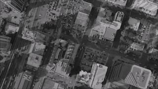
пример: покупка автомобиля в Запорожье
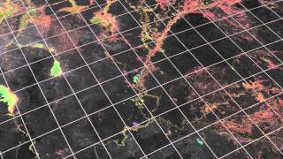
Rezatec Earth Observation Remote Sensing Satellite Data analytics
 У вашего броузера проблема в совместимости с HTML5
Rezatec was formed in 2012 to help businesses better manage their land-based assets by making use of the increasingly sophisticated but complex array of Earth Observation (EO) imagery and data available. We do this through our unique landscape intelligence platform aggregating large amounts of diverse data from satellites, airborne and ground instruments, applying relevant modelling and using our mapping, measuring and monitoring techniques with best-in-class technology to provide critical decision support for our customers.
Похожие видео


Мой аккаунт