
Thursday, 15 January, 2026г.


Где искать: по сайтам Запорожской области, статьи, видео ролики
пример: покупка автомобиля в Запорожье
NASA-USGS Landsat 8 Handoff
 У вашего броузера проблема в совместимости с HTML5
Today, the latest in the Landsat series of Earth observation satellites, Landsat 8, begins its mission to extend an unparalleled four-decade record of Earth's landscape as seen from space. The Landsat program is a joint effort between the U.S. Geological Survey, which assumed operation of the satellite today, and NASA.
USGS, NASA, and elected officials marked the transfer of the satellite in a brief ceremony today at the USGS Earth Resources Observation and Science Center (USGS-EROS) in Sioux Falls, S.D.
NASA launched the satellite as the Landsat Data Continuity Mission on February 11. Since then, NASA mission engineers and scientists, with USGS collaboration, have been putting the satellite through its paces -- steering it into its orbit, focusing the instruments, calibrating the detectors, and collecting test images. Now fully mission-certified, the satellite today switches to USGS operational control as Landsat 8.
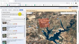
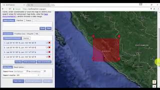
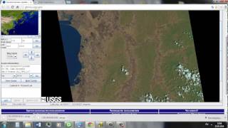
To learn more visit http://landsat.usgs.gov
Похожие видео

Мой аккаунт