
Monday, 12 January, 2026г.


Где искать: по сайтам Запорожской области, статьи, видео ролики
пример: покупка автомобиля в Запорожье
Satellite navigation-GPS|NAVIC|BeiDou|Gelileo|GLONASS|QZSS|DORIS|Top Satellite navigation
 У вашего броузера проблема в совместимости с HTML5
This video covers the information about the satellite navigation of different countries in the world.
A satellite navigation or satnav system is a system that uses satellites to provide autonomous geo-spatial positioning. It allows small electronic receivers to determine their location |longitude, latitude, and altitude/elevation| to high precision |within a few metres| using time signals transmitted along a line of sight by radio from satellites.
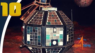
A satellite navigation system with global coverage may be termed a global navigation satellite system (GNSS). As of December 2016 only the United States NAVSTAR Global Positioning System (GPS), the Russian GLONASS and the European Union's Galileo are global operational GNSSs. The European Union's Galileo GNSS is scheduled to be fully operational by 2020.[1] China is in the process of expanding its regional BeiDou Navigation Satellite System into the global BeiDou-2 GNSS by 2020.[2] India currently has satellite-based augmentation system, GPS Aided GEO Augmented Navigation |GAGAN), which enhances the accuracy of NAVSTAR GPS and GLONASS positions. India has already launched the IRNSS, with an operational name NAVIC |Navigation with Indian Constellation|, a constellation of satellites for navigation in and around the Indian Subcontinent. It is expected to be fully operational by June 2016. France and Japan are in the process of developing regional navigation systems as well.
Global coverage for each system is generally achieved by a satellite constellation of 18–30 medium Earth orbit |MEO| satellites spread between several orbital planes. The actual systems vary, but use orbital inclinations of greater than 50° and orbital periods of roughly twelve hours |at an altitude of about 20,000 kilometres|. #Trendingrainbow
Теги:
gps satellite navigation system galileo glonass nasa isro positioning orbit indian army india vs pakistan india vs pak india vs china pakistan about india pakistan media on india indian defence update indian defence indian defense indian military navik indian regional navigation satellite system indian space research organization indian gps india gps isro gps nissan gtr gta Glonass Beidou Beidou 1 Irnss Qzss Doris NASA earth Earth Asteroid Cassini
Похожие видео


Мой аккаунт