
Wednesday, 14 January, 2026г.


Где искать: по сайтам Запорожской области, статьи, видео ролики
пример: покупка автомобиля в Запорожье
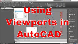
Autocad:Implementing scales in drawings (e g 1:200)
 У вашего броузера проблема в совместимости с HTML5
A simple way of creating scales (e.g. 1:200) in your Autocad drawings. Plot in layout using vewports and acquire your drawing in any scale you like (1:100, 1:200, 1:500,1:1000 1:2000, 1:5000 etc.)
Watch my other relevant videos:
Scale a georeferenced image in one Axis only(e.g. in case of a bad scanning)
https://www.youtube.com/watch?v=rcDkRR-VoXo
Autocad: "Invisible" printing
https://www.youtube.com/watch?v=6QKa3JH0IKs&t=11s
Autocad: How to create .plt file after installing a plotter's configuration
https://www.youtube.com/watch?v=EHgWkEQ_ngU&t=3s
ArcGIS: Manage .dwg files to ArcMap and convert to shapefiles(.shp)
https://www.youtube.com/watch?v=5ZTejRQJobI
ArcGIS: Plot in ArcMap (Import Scale, Grid, Legend, Scale Bar in layout)
https://www.youtube.com/watch?v=PUSfOOCcmyQ&t=38s
Autocad: Convert a shapefile(.shp) to a .dwg and the opposite, georeferenced
https://www.youtube.com/watch?v=UEq3jIR-6do&t=7s
Measure width and height of a photograph in pixels and resize it
https://www.youtube.com/watch?v=-1WIqNmVpBE
View any forgotten passwords saved in your computer
https://www.youtube.com/watch?v=ZRZ9AHWtWAQ
Autocad:Display points from your country's coordinates to Google Earth
https://www.youtube.com/watch?v=Sia8JTOd00Y
Autocad: Measure and divide a polyline to equal segments
https://www.youtube.com/watch?v=6erDzT9_tyA
Arc Gis: Insert Gps points in Arc Map and create shapefile
https://www.youtube.com/watch?v=wppoaYNSu1M
Теги:
Autocad scale drawing plot 1:200 layout survey engineering print dwg plotter manager viewport 比例1:200 Kiwango 1: 200 Escala 1: 200 مقياس 1: 200
Похожие видео
Мой аккаунт